Ramona Falls
A romantic, leisurely hike with fairytale views when you choose the right path

Ramona Falls
OVERVIEW
A popular hike with a river crossing that requires tightroping across a fallen tree. The risk brings rewards, including a picturesque creek and one of the area’s most majestic waterfalls.
ADDRESS
Ramona Falls Trailhead, Rhododendron, OR
Directions
19 minutes from Mt. Hood Alpine Chalet
FIELD NOTES + INSIDER TIPS
Level: Easy/Moderate | 7.1 Miles | 1,046’ Gain | 3,470’ Elevation
This 7-mile lollipop loop trail takes you on a 3.5-hour tour with picturesque, riverside views of Mount Hood that lead to a cascading, 120-foot waterfall and an absolutely magical section of the Pacific Crest Trail. The downside: a seasonal footbridge that once ensured safe passage to hikers washed away in 2014, and the Forest Service isn’t planning a replacement anytime soon. At this time, we don’t recommend the hike for most pets or kids under 10.
The road there isn’t perfect either. While paved, the last mile has a few foot-deep potholes (AKA craters) that are best approached in a high-clearance vehicle. That said, we saw a Tesla parked safely in the lot when we arrived. The parking area provides access to multiple trails, including some multi-day hikes, so make sure to head out in the right direction. We went southeast and found the Sandy River Trail No. 770 toward Ramona Falls.
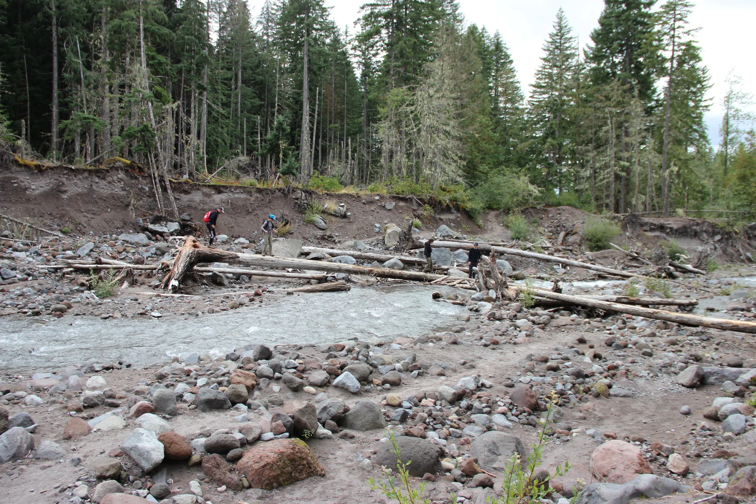
Glacial River, Volcanic Soils
You’ll set out into a boreal forest of towering Douglas fir, perfectly plumb lodgepole pines and stunted mountain hemlock. Off the trail, pinemat manzanita, prolific mosses and reindeer lichen create a blanket of varied greens. In the distance, you might already hear the faint rush of a river.
Just under a mile into the hike, you’ll come to a massive boulder cleaved in two. We like sharing stories of how the rock broke in two, and stopping for a few photos. Soon after, you’ll approach a station for filling out free, self-issued wilderness permits. These are required from May 15 to October 15, and can save your life. By now, that faint rush will be much more pronounced as you arrive at the Wild and Scenic Sandy River and your first clear view of Mount Hood.
Your options: find a good logjam to walk or scoot across, or bring gear to ford the river. Both are still dangerous propositions in spring and on any day storms are forecasted in the area. The safest time to visit is from mid-summer to early fall when rainfall in Oregon is at its lowest. Even then, you can get turned back (like we have) if the logs don’t fall in your favor. For fording tips, read the Forest Service’s River Crossing Guide and follow our golden rule: always live to hike another day.
The Sandy River is a sight to see unto itself–a dramatic example of the force a glacial-fed river can have on a volcanic landscape. In roughly 1780, pyroclastic flows from Mount Hood buried the Sandy River. Every year since, storms and glacial ablation have helped it carve through the soft strata, expose more physical signs of volcanic debris flow and rechart its course time and again. It’s a landscape in constant transition.


Rhododendron Blooms, Mountain Views
Once across, you’ll climb out of the riverbed toward an opening in the riparian brush. A section of dry, sandy trail curves left and then right up into the forest. Before long, you’ll come to the Pacific Crest-Sandy River Trail Junction at 1.5 miles. This is where the lollipop stick ends, so you can choose your own adventure. We went straight along the north side of the river, which offers a cinematic approach to the falls.
In early summer, this part of the hike is lush with massive, pink blooms popping out of what is arguably the most dense stand of Rhododendrons we’ve seen on the mountain. This two mile stretch is a gradual climb that you might not notice if it weren’t for the occasional clearing. A couple good rest stops offer views of the deepening channel, which you are now quite a ways above. Upriver, Mount Hood stands tall offering consistent views on a clear day.
The last half mile is the only section that was remotely steep. As the trail climbs away from the river, the canopy of trees becomes dense and a soft rumble permeates everything. The rumble becomes a roar even as trees shield the magic. You reach a shelf, catching glimpses of Ramona Falls through the trees, before coming into clear view.
The falls start from a single point and split into ever smaller whisps of water that cascade over and between moss-covered columnar basalt. The temperature seemed to drop 10 degrees at this point, but we still managed to find a good sitting rock, enjoy a meal and sink into nature’s beauty. Before you leave, drop into the base of the falls and get a closeup of this 120-foot wall of whitewater. Breathe in the mist, and fail gleefully at capturing its essence through photo.
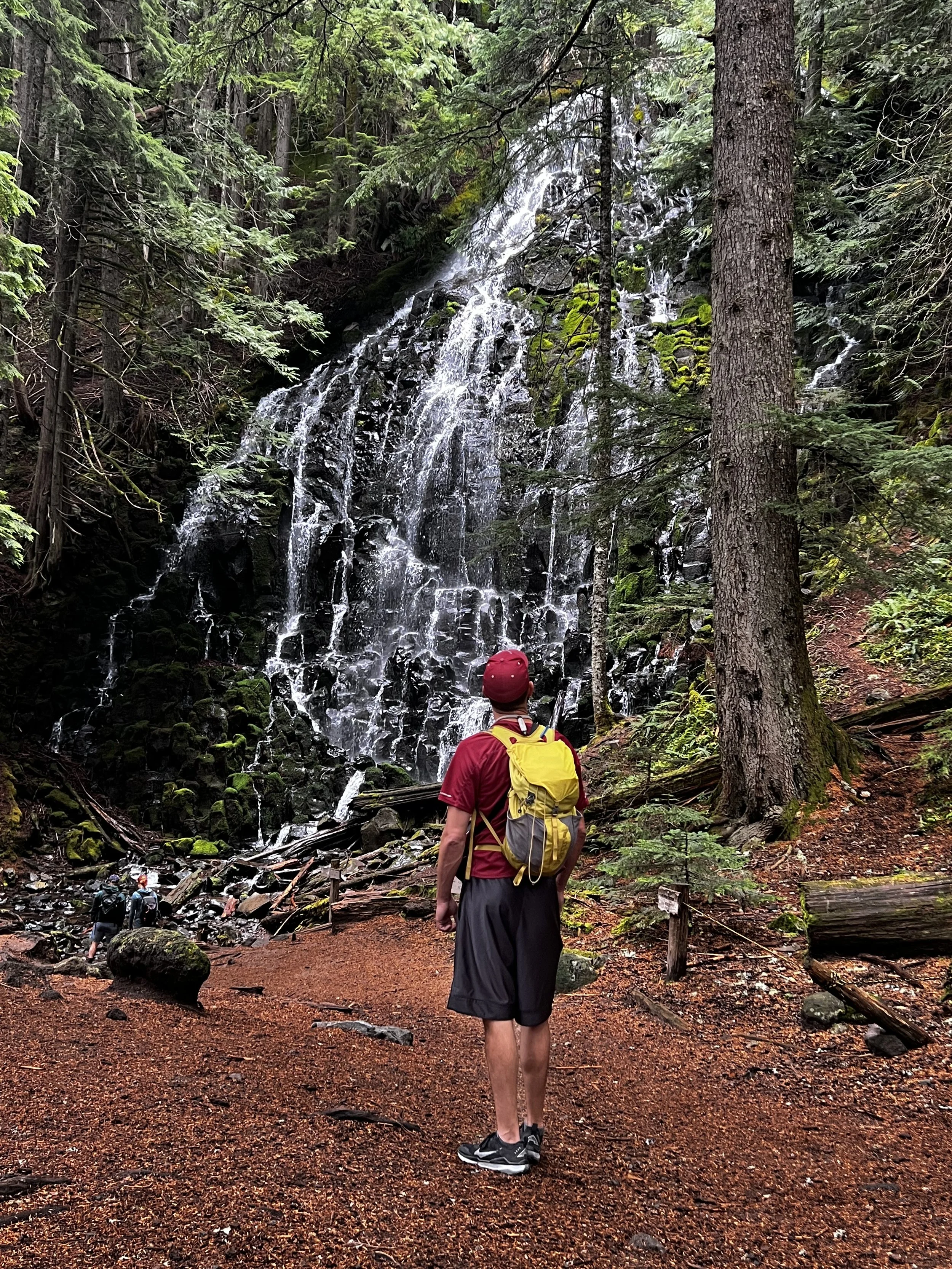
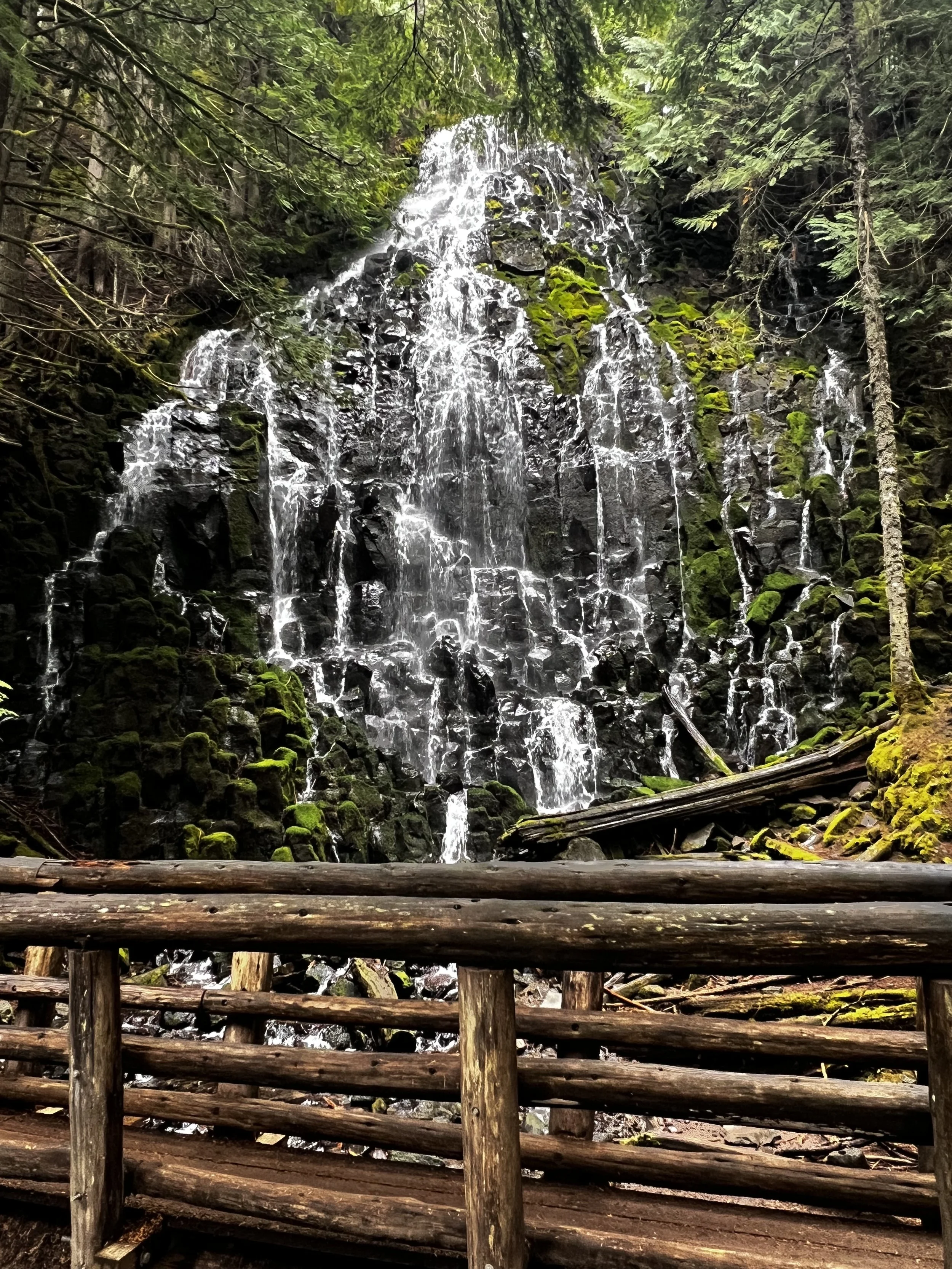
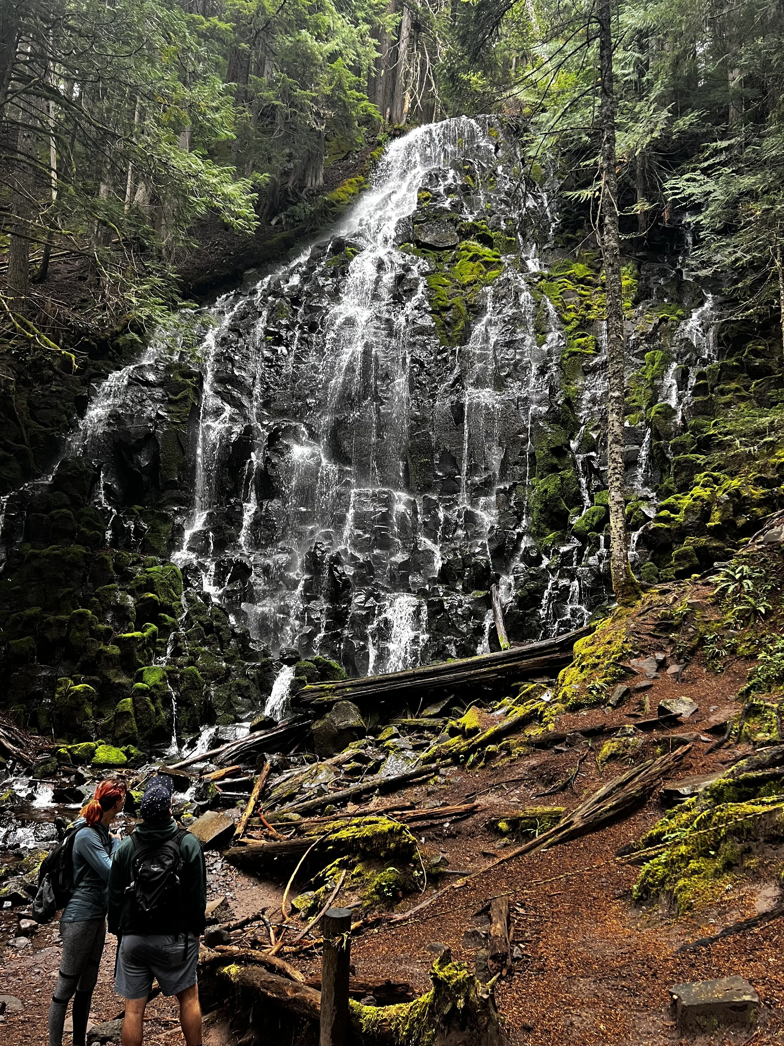
Woodland Creek, Mountain Base
A footbridge offers another great vantage point, and the perfect route back to your car. Continue onto the trail and keep left at the nearby fork to head back on Ramona Falls Trail #797. What lies ahead is a gentle downhill trail that follows Ramona Creek as it meanders through a mossy forest floor, pouring over rocks and pooling fallen trees. The pools are perfect for tiny waders and panting pets to rest, explore or just pass some time.
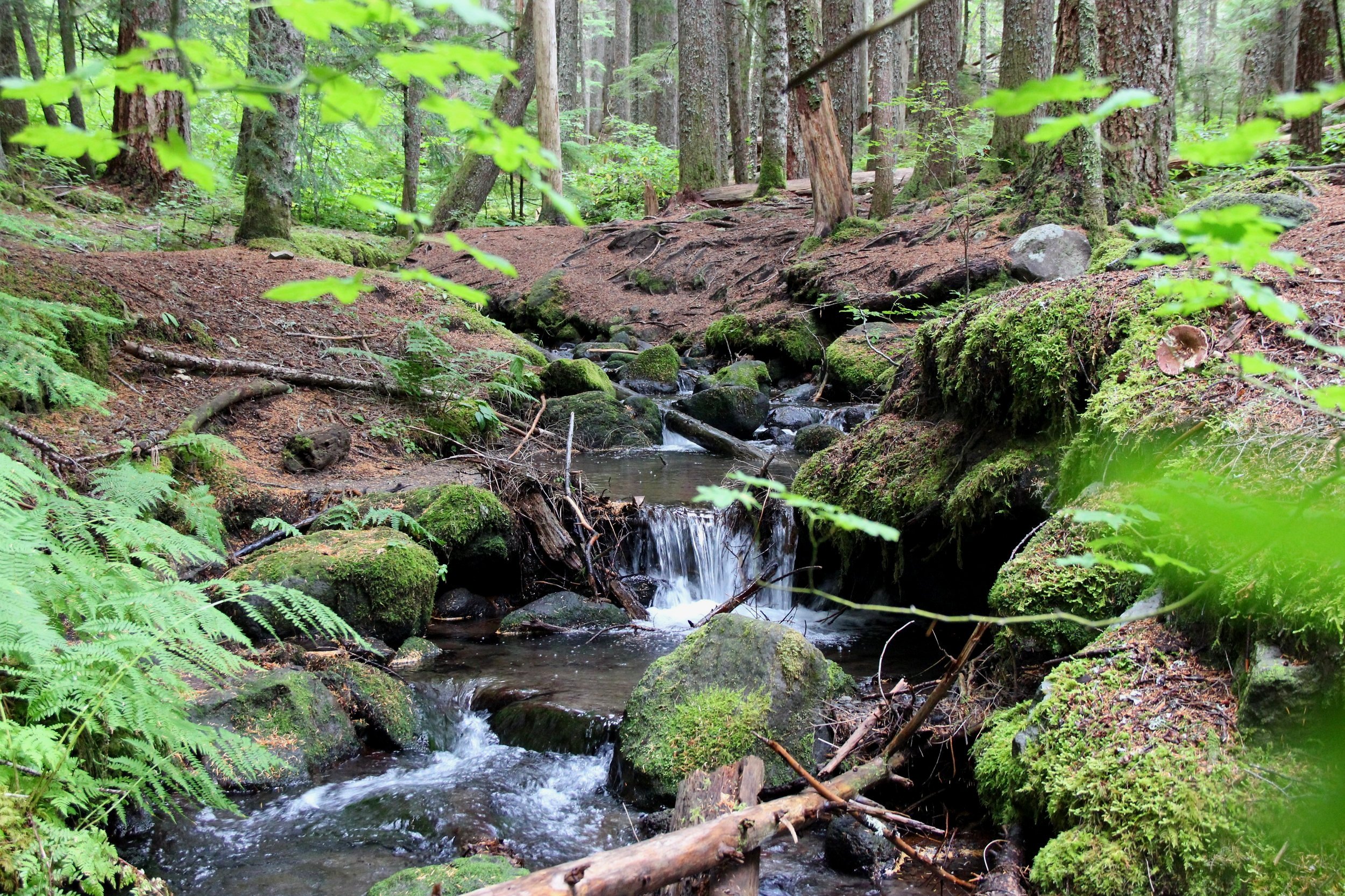
As you descend, a massive cliff juts upward above the forest on your right. The rocky face paints swaths of tan and gray behind the trees. This granite bluff sits at the foot of Yocum Ridge and forms part of Mount Hood’s base. You’ll follow the base of this divide where–depending on the season–wildflowers and mushrooms sprout up in tiny colonies.
Around 4.7 miles, you’ll walk out from under this lush habitat and back onto the volcanic sediment of a braided floodplain that has been shaped by the Muddy Fork and Sandy River. Roughly another half-mile down trail, you’ll tee into the Pacific Crest Trail. Head left here to return to the parking lot. Going right takes you up to trails connecting Bald Mountain and McNeil Point–another one of our favorite hikes.
As you head back to the car, you’ll weave through toppled trees, cross a Forest Service foot bridge and get another chance to show off your balancing skills at the Sandy River crossing. Take in a few last glimpses of Mount Hood and the surrounding abundance before you head for the hot tub at Mount Hood Alpine Chalet. On the way back, stop at Koya Kitchen to sip a beer while swaying in a hammock (like we did!) or relax on the patio at Skyway Bar & Grill.